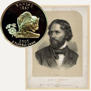
Today, the Kansas State Quarter Coin remembers when the first Fremont expedition reached what is now known as Lawrence on June 12, 1842.
From Kansas, A Cyclopedia of State History, Embracing Events, Institutions, Industries, Counties, Cities, Towns, Prominent Persons, Etc., Volume I, Edited by Frank W. Blackmar, published in 1912:
=====
Fremont’s Expeditions. —
The explorations of John C. Fremont, made under an act of Congress, were of much importance in placing before the people a faithful description of the region west of the Mississippi and Missouri rivers.
His first was made in 1842 with only 21 men, collected in the neighborhood of St. Louis, principally Creole and Canadian voyageurs who had become familiar with prairie life in the service of the fur companies in the Indian country.
Charles Preuss, a native of Germany, was his assistant in the topographical part of the survey; L. Max well of Kaskaskia was engaged as hunter, and Christopher Carson (more familiarly known as “Kit” Carson) was the guide.
From St. Louis the party proceeded to Cyprian Chouteau’s trading house on the Kansas river, about 10 miles west of the Missouri line. The start was made from that point on June 10, 1842.
In about 10 miles they reached the Sante Fe road, along which they continued for a short time, “and encamped early on a small stream, having traveled about 11 miles.”
They traveled the next day along the Sante Fe road, which they left in the afternoon, and encamped late in the evening on a small creek, called by the Indians, Mishmagwi.
On June 12 the party seems to have camped near the site of Lawrence, for in Col. Fremont’s narrative he says: “We encamped in a remarkably beautiful situation on the Kansas bluffs, which commanded a fine view of the river valley, here from 3 to 4 miles wide. The central portion was occupied by a broad belt of heavy timber, and nearer the hills the prairies were of the richest verdure.”
On the 14th he crossed to the north side of the river, probably near the point where Topeka is now located.
On the 16th he says: “We are now fairly in the Indian country, and it began to be time to prepare for the chances of the wilderness.”
The party continued its journey along the foot of the hills which border the Kansas Valley, and on the 20th crossed the Big Vermilion, “which has a rich bottom of about one mile in breadth, one-third of which is occupied by timber.”
After a day’s march of 24 miles they reached the Rig Blue, and encamped on the uplands of the western side, near a small creek, where was a fine large spring of very cold water.
At noon on the 22nd a halt was made at Wyeth’s creek, in the bed of which were numerous boulders of dark, ferruginous sandstone, mingled with others of the red sandstone variety.
At the close of the same day they made their bivouac in the midst of some well-timbered ravines near the Little Blue, 24 miles from their camp of the preceding night.
Crossing the next morning a number of handsome creeks, with water clear and sandy beds, at 10 a. m. they reached a beautifully wooded stream, about 35 feet wide, called Sandy creek, “and, as the Otoes frequently winter there, the Otoe fork.”
After another hard day’s march of 28 miles they encamped on the Little Blue, “where our arrival made a scene of the Arabian Desert.”
Thence their route lay up the valley, and on the night of the 25th they halted at a point in what in now Nuckolls county, Nebraska.
“From the mouth of the Kansas, according to our reckoning, we had traveled 328 miles, and the geological formation of the country we had passed over consisted of lime and sand stone, covered by the same erratic deposits of sand and gravel which forms the surface rock of the prairies between the Missouri and Mississippi rivers.”
They marched up the Platte valley, but upon reaching the forks, the main party was sent up the north fork, while a few men under Fremont passed up the south fork to St. Vrain’s fort.
From here they marched northward to the north fork and joined the main body at Fort Laramie.
Although the Indians were on the warpath farther up the river, Fremont determined to proceed.
They continued to advance without serious interruption, arrived at the Sweetwater river, marched through South Pass, and a little later ascended the highest peak of the Wind river mountains.
The return journey down the Platte was made without notable incident.
=====
The Kansas State Quarter Coin shows with a portrait of John C. Fremont, circa 1856.