Look up, can you see it? There’s a rickety footbridge spanning the pass 90 feet up in the air. A young, terrified yet excited soldier hurries from one side to the other carrying ammunition and supplies to the men guarding the rail line. Be quiet and listen, you can hear the painful moans of the wounded and dying men.
Well, the bridge is no longer there, neither is the rail line, and you can’t really see a young soldier, but you can certainly hear the moans. Oh, they’re not really the ghostly sounds of the wounded soldiers, but if the wind is gently blowing, the trees rub together making an eerie, moaning sound. With a little imagination, the sounds remind you of the men who lost their lives in the battle at Allatoona Pass on October 5, 1864.
Allatoona Pass and the rail line through it proved critical to General Sherman’s Civil War strategies. Having scouted and surveyed the Allatoona area prior to the war, Sherman knew the steep terrain and knew how important the rail pass was to his troops. The Western & Atlantic Railroad, now CSX, brought supplies and ammunition to the federal troops through that pass. On the march from the north to the south, Sherman avoided this area when possible to save his men the hardship of walking along the steep hillsides. Since Allatoona Lake was filled in the 1950s, the height of the hills and the depths of the valleys are no longer visible, but the hilltops above the water provide a glimpse of the difficult terrain.
Today, the area is a protected park and includes well-marked trails. On the Allatoona Pass trails, the local history of the civil war comes alive. The interpretive signs along the paths describe the men and the conditions of that time. You walk where those men walked, and you see in your mind’s eye their struggles while the sounds of gunfire and cannon blasts thundered on the hillsides all around them.
Beginning your adventure at the parking area, one of the first signs shows pictures from the 1860s. An active train pulls through the pass between bare hillsides and alongside the houses that sprouted on the transportation route. Across today’s street, one nicely kept house still stands from that era, easily recognizable in the picture from 147 years ago. Looking northward, the old railway bed travels through the pass with its steep sides and trees shading the trail. Walking toward the pass, a portion of the trail turns right past the memorial area and up to the hilltop strongholds.
Up from the lake and in the shadow of trees, a semi-circle of monuments honors the men from the various fighting groups of 11 states – both the blue and the gray. Granite markers, both small and large, remember the men of the regiments from Ohio, Minnesota, Wisconsin, North Carolina, Alabama, Louisiana, Iowa, Illinois, Texas, Missouri and Mississippi. The memorial serves as a simple and powerful reminder of all the men, their bravery and their hardship, fighting on these hills in October 1864.
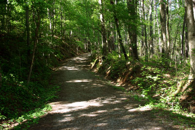
In addition to the rail line, there were wagon roads supplying the farms and towns between Atlanta and Tennessee. In fact, the Tennessee Wagon road forms the basis of the trail as it climbs to the defensive camps at the top of the hills. Not to worry, the trail is not too steep. Teams of horses and mules hauled loaded wagons up these same hillsides. Leaning forward a bit, your calf muscles pull slightly, but think about those teams of horses. In the October morning coolness, their coats steamed, sending a fog into the air as they labored to pull their wagons loaded with supplies to the men at the top.
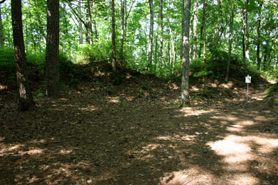
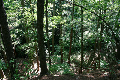
Today, trees shade the wagon road keeping the trail relatively cool with the lake just down the hill. After climbing, the road bed crests with the interpretive trail branching into spurs to the right and the left. The wagon road continues downhill, though not as a part of the trail, for a few hundred yards into the lake. To the right, the trail travels upward to the Eastern Redoubt, the Federal Trenches and the location of the crow’s nest lookout tree. From the old pictures on the signs, very few trees covered the hills during the fighting. While mature trees now cover the area, the earthen border of the redoubt and the fighting trenches still visibly exist.
What is a redoubt, you ask? A redoubt is a fort or fort system usually relying on earthen construction, though some can be brick or stone. At Allatoona Pass, the men constructed the Eastern Redoubt of six foot tall earth walls surrounded by a six foot deep ditch. Since the battle occurred in October, the men dug and built this defensive position with their sweat and hard work under the hot Georgia sun. During the fighting, men from Minnesota, Illinois and Ohio manned the Eastern Redoubt. Today, from this hilltop height, Lake Allatoona presents a panoramic view through the trees.
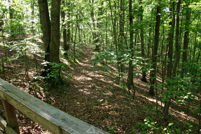
In addition to digging and building the redoubt, the soldiers dug trenches on the hillside. The trail crosses one trench with a protective wooden footbridge. The deep and long trench wraps around the hill. Remember, in the 1860s, men moved the earth from these trenches not machines. Many men walked these hills, but how many carried shovels? Wouldn’t it be interesting to know how many shovels, how many men and how long they took to dig?
Circling back to the old road, the trail gently climbs the opposite hilltop to the Minnesota regimental headquarters. There, officers sheltered in a dog-trot frame house developing strategies to protect the pass and to minimize men lost. As the fighting continued, messages arrived via the signal tree from Sherman at Kennesaw Mountain that help was on the way. Just imagine, from hilltop to hilltop, Kennesaw Mountain to Allatoona Pass, the visual signals passed from the General to the troops giving them courage to continue the fight.
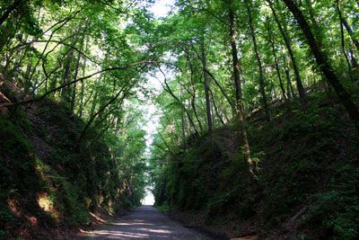
From the headquarters, the trail descends along the hillside of the pass down to the rail bed. The easy to moderate trail follows the slope, but as you walk down, you can see the hand dug cliffs on either side of the pass. With today’s machinery and a handful of men, the pass could be easily cut. Consider the men and horses it took to dig and move that much dirt and granite. Interestingly, they dug the upper part of the pass wider to prevent the dirt and rocks from falling onto the track. But, granite makes up most of the lower pass. The men blasted and moved only the rock necessary for the trains. Still, weeks and months of work show in the depth and breadth of the pass. In wartime, the soldiers would have destroyed all the effort in this pass to cut the supply line.
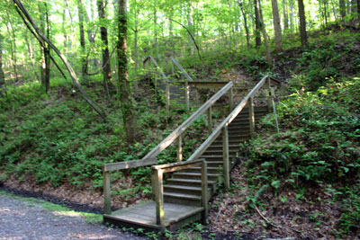
Across the rail bed, wooden stairs and cross ties go up to the Star Fort. This climb challenges your muscles as you move almost vertically upward. At the top, soldiers took refuge and defended their position within the Star Fort. Built much like the redoubt, interwoven cross ties topped the walls making a star pattern, hence the name, Star Fort. Today, the earth walls outline the area where maybe 100 people could move tightly but easily. In 1864, 700 men, many wounded, gathered in the fort literally on top of each other to defend the pass.
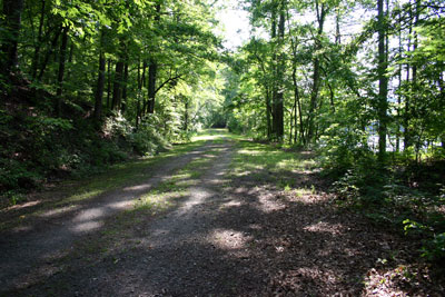
Back down at the rail bed, the easiest part of the trail follows the old railroad. This flat, wide and gently winding trail takes you over fingers of the lake staying near the lake shore. Trees shade most of the trail while native bushes and flowers bloom on either side.
The trail is well-kept and provides easy to moderate hiking along with brief, informative signs about the men, battles and importance of the Allatoona Pass during the Civil War.
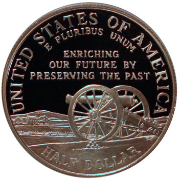
How does this relate to coins?
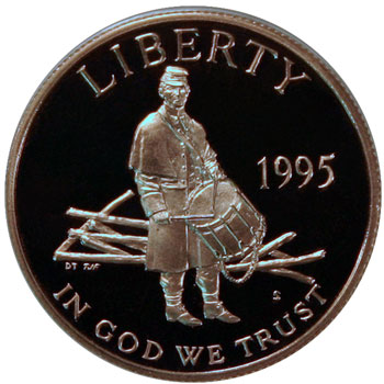
The 1995 Civil War commemorative half dollar easily represents the Allatoona Pass, both on the obverse and reverse, regardless of the models used by the artists.
From the coin’s obverse, the drummer boys helped the various leaders at the Allatoona Pass communicate with their troops.
Though the area now includes a lake and a forest, back then the land was farmed and could easily look similar to the reverse of the coin.
Today, October 5, 2011, represents the 147th anniversary of the Allatoona Pass battle. Let’s let the coin and the date remind us to take a moment to remember those men of yesteryear who valiantly fought on nearby land.
